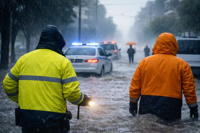
Red Alert for Incoming Severe Weather in Greece: What It Means and How to Stay Safe
A Red Alert is not a routine forecast. It signals a heightened risk of dangerous weather impacts in specific areas—most commonly flash flooding, intense thunderstorms, frequent lightning, and strong winds. In Greece, these conditions can turn risky quickly, especially in places with low-lying streets, underpasses, streams and ravines, and coastal roads exposed to wind and wave action.
This guide explains what a Red Alert typically means for the public in Greece and the practical steps that can protect lives—before, during, and after the storm.
Why severe weather can become dangerous fast in Greece
Greece’s terrain and infrastructure create a few “high-risk patterns” during intense storms.
Heavy rain can funnel into narrow valleys and urban drainage systems quickly. Streets that look passable can flood in minutes. Water can also collect in underpasses, basements, and ground-floor storage areas.
Strong winds may bring down branches, signs, and unsecured objects from balconies and rooftops, especially in dense urban areas. In coastal zones, wind and rain can reduce visibility and stability on roads and create sudden hazards near exposed shorelines.
The biggest risk factor in many serious incidents is not the storm itself. It is unnecessary movement during peak conditions—driving through water, crossing streams, or “checking damage” too early.
For official self-protection instructions, see the Civil Protection instructions for storms.
🎧 Watch or listen to the analysis in video format
What to do right now (a short checklist that saves lives)
If you have ten minutes, focus on the basics. The goal is to reduce exposure and prevent common accidents.
Limit travel.
If you do not have to go out, stay in. If you must move, plan a safer route and avoid low points and known flood spots.
Secure anything that can blow away.
Balconies and_attach points matter. Bring in or anchor chairs, tables, plant pots, tools, and loose items. Wind turns objects into hazards.
Prepare for outages.
Charge phones and power banks. Keep a flashlight where you can reach it quickly. Have a small reserve of drinking water and essential items.
Protect lower areas of your home.
Move valuables and electrical items away from floors in basements or ground-level storage spaces. Raise extension cords and power strips.
Check drainage only if it is safe.
If wind is already strong or you need to use a ladder, do not attempt it. Falls cause injuries even before the storm peaks.
Check on vulnerable people.
Call older relatives or neighbors. Ask if they have medications, water, and a safe plan if power goes out.
The number one rule: never enter floodwater
Floodwater is not just “water on the road.” It can hide open drains, debris, and sudden drop-offs. It can also move with surprising force.
Do not drive through flooded streets.
You cannot judge depth reliably. Even shallow moving water can sweep a vehicle sideways, especially near underpasses or where water is flowing across the road.
Do not walk through floodwater.
You may step into an open drain or a hole in the pavement. Footing disappears fast in moving water.
Stay away from streams and ravines.
In Greece, small channels can turn into fast torrents quickly. A sudden surge can arrive without warning, including after rainfall upstream.
Safer driving during severe weather
If travel is unavoidable, treat it as a risk-managed task.
Drive slowly and increase following distance. Avoid sharp steering and hard braking. Stay alert for debris and standing water.
Avoid underpasses and roads that flood easily. If you see water covering the roadway, turn around and choose another route. “Just getting through” is not a plan.
Do not park under trees, near signs, or beside unstable structures during high winds. If conditions worsen, find a safer place and wait for the peak to pass.
Lightning safety: what to do at home and outdoors
Lightning is one of the most underestimated hazards in severe storms.
If you are outdoors, your priority is to get into a substantial building or a hard-topped vehicle. Do not shelter under trees. Move away from open areas, metal fences, and poles.
If you are near the sea, get out of the water and away from the shoreline during storms. Water and wet surfaces increase risk.
Indoors, avoid unnecessary use of corded electronics during intense lightning. Avoid contact with plumbing fixtures if lightning activity is frequent and close.
High winds: prevent injuries from falling objects
Wind hazards are often preventable with basic steps.
Bring in or anchor balcony items. Keep children away from balconies and open windows during gusts.
Avoid walking or standing near scaffolding, loose signage, or old trees during peak winds. If you see downed power lines, keep your distance and alert the proper authorities.
After the storm: avoid the “false safe” moment
Many injuries happen after the worst rain stops, when people go out immediately.
Do not enter flooded basements or rooms until you are confident it is safe—especially if there is any chance that electrical systems are affected. Avoid stepping into muddy areas where you cannot see the ground.
Be cautious of damaged pavement, open drains, and unstable debris. Treat the first hours after severe weather as a continuation of risk, not the end of it.
A clear takeaway
In a Red Alert, the safest choice is usually the simplest one: reduce travel, avoid water, stay informed, and follow official instructions. Serious incidents often come from small decisions—crossing a flooded road, walking “just a few meters” through water, or trying to secure something too late.
Preparation does not need to be dramatic. It needs to be timely, calm, and practical.
If you want, tell me the main area you’re targeting (for example, Peloponnese, Thessaly, Attica, Central Macedonia, or the islands). I can adapt the article with location-specific risk reminders that fit Greece—urban flood points, coastal wind exposure, or mountain road issues—without making it feel generic.


